Caroline County Virginia Attractions and Historic Sites
Most attractions in Caroline County are historic sites linked to the Civil War 1864 Overland Campaign of Union General Ulysses S. Grant. There are many historic markers throughout Caroline County citing the movements and delaying actions of Confederate General Robert E. Lee’s Army of Northern Virginia and the Union Army of the Potomac commanded by George Meade between the Battle of Spotsylvania Court House to the Battle of North Anna (River) before heading east to the Battle of Cold Harbor. We have taken photographs of many attractions and historic sites in Caroline County, and researched many of these historical markers. The pictures are in the following albums:
- Caroline County Among 114 photographs are Moss Neck: Jackson’s Headquarters, Skinker’s Neck, Rappahannock Academy, Lee and Grant at the Battle of North Anna River, Grant’s Operations between the North Anna River and Cold Harbor, Historic Homes in Port Royal, Historic Caroline County Courthouse (c. 1835), and historical marker of Edmund Pendleton’s home.
- Port Royal, Caroline County This album has 32 photographs of historic homes, churches, and municipal buildings of the historic port town of Port Royal. The story of the chase and capture of John Wilkes Booth is told in detail through these pictures.
- Lake Caroline Subdivision There are 10 photographs of Lake Caroline and community amenities.
- Ladysmith Village Subdivision This album has 19 photographs of community amenities, single-family homes and townhouses, Caroline Library (Ladysmith Branch), and Lewis and Clark Elementary School.
- Lake Land’Or Subdivision There are 10 pictures of Lake Heritage and Lake Land’Or and surrounding community amenities.
Caroline County Parks and Recreation operates facilities supporting several youth and adult programs. There are 3 community parks in Caroline County which are listed below:
- Caroline Recreation Park: Behind Caroline County High School at 19127 County Park Road Milford, Virginia 22514.
- Robert Farmer Park: Behind Bowling Green Elementary School at 16221 Richmond Turnpike Bowling Green, Virginia 22427.
- Lowe-Massey Park: Behind the Dawn Progressive Center at 16403 Dawn Boulevard Hanover, Virginia 23069.
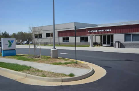
A Rappahannock Area YMCA located near the subdivisions of Bridlewood, Caroline Pines, Ladysmith Village, Lake Land’Or, Lake Caroline, Pendleton, and Tanglewood offer residents a complete fitness facility and community center. Business hours for the Caroline Family YMCA are as follows: 5 a.m. to 9 p.m. (Monday – Friday); 7 a.m. – 7 p.m. (Saturday); Noon until 5:00 p.m. (Sunday). The following programs are available at the Caroline facility next to Ladysmith Village:
- Aquatics: American Red Cross life guard certification.
- Aqua Fitness: Aquatic fitness classes, aquatic personal training, aqua zumba, swim lessons, water therapy.
- Childcare: Before and after school programs, childcare camps, child watch, parents night out.
- Home Schooling Fitness and Aquatics Programs
- Music and Dance Lessons
- Preschool
The Rappahannock River, Mattaponi River, and Lake Anna (Spotsylvania County) all have public boat launches and offer great opportunities for boating and fishing.
Historical events include the December 1862 Defense of Old Port Royal by Confederate Major General D. H. Hill, and the action of Major General Jubal Early blocking attempts by Union engineers to build a bridge over the Rappahannock River at Skinker’s Neck, present day Four Winds Golf Course. These actions forced Army of the Potomac Commander Ambrose E. Burnside to cross the river at Fredericksburg which led to the attack of Marye’s Heights and a Confederate victory. Caroline County is also known for the farm of Richard H. Garrett, between Port Royal and Bowling Green on current day Highway 301. On April 26, 1865 soldiers of the 5th New York Cavalry cornered John Wilkes Booth in the barn of the Garrett Farm and fatally shot him.
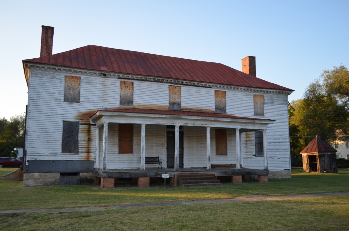
This is the Brockenbrough and Peyton House (c. 1761) In the historic town of Port Royal. John Wilkes Booth was brought to this home in the Town of Port Royal while avoiding capture by Union soldiers searching for him after assassinating President Lincoln on April 14, 1865 at Ford’s Theatre in Washington, D. C. just 5 days after the surrender of the Army of Northern Virginia by Confederate General Robert E. Lee.
During this conspiracy, David Herold attempted to murder Secretary of War Edward Stanton while George Atzerodt was assigned to kill Vice-President Andrew Johnson. But Atzerodt lost his nerve while getting drunk in a Washington, D. C. saloon. This caused only Booth and Herold to immediately flee the city causing the largest manhunt in the history of the United States.
On April 25, 1865, the 16th Union Cavalry Regiment were in Port Conway in King George County on the north side of the Rappahannock River. While at this small port town William Rollins and his wife Bettie Rollins were interrogated about the whereabouts of the conspirators. They informed the detectives with the National Detective Police they observed two men matching the description of Booth and Herold crossing the river into Port Royal the previous Monday with Willie Jett. The Rollins informed them if they wanted to find Willie Jett he would probably be at the Star Hotel in Bowling Green. The search party was informed Willie Jett was courting Izora Gouldman (1847-1929), the daughter of Henry Gouldman, the owner of the Star Hotel in Bowling Green.
When the conspirators reached Port Royal they were turned away by Sarah Jane Peyton. They were then refused lodging at the Catlett House across the street. Mrs. Elizabeth Catlett suggested the tobacco farm of Richard H. Garrett, half-way to the town of Bowling Green, would be the best place for them to hide. The women were questioned about this encounter by Lieutenant Edward Paul Doherty (1840-1897) who commanded the local search for Booth and Herold. Lieutenant Doherty then gave the information to government detectives Luther B. Baker and Everton J. Conger who ware assigned to accompany Lieutenant Doherty during the search. During questioning she also informed the search party that she recognized one of the Confederates with the conspirators as Confederate Private William S. Jett. He was known as a member of the 9th Virginia Cavalry (Mosby’s Rangers) before General Lee surrendered the Army of Northern Virginia.
The tobacco farm of Richard H. Garrett was immediately searched. Although Booth and Herold were at the farm, they were not discovered hiding in the barn inside a pile of hay. Lieutenant Doherty’s search party then followed the lead given to them at Port Conway, and traveled south toward the town of Bowling Green. Shortly after midnight on April 26th, Lieutenant Doherty and members of the 16th Union Cavalry Regiment surrounded the Star Hotel and found Willie Jett, shoved a Colt pistol in his face and ordered him to talk. Willie Jett then led them back to the Garrett Farm which in present day is in the median of Highway 301.
Secretary of War ordered that the conspirators be captured alive and interrogated to confirm the depth of the assassination of President Lincoln. When Lieutenant Doherty’s search party surrounded the barn on Garrett’s Farm, David Herold surrendered willingly and was tied to a locust tree as John Wilkes Booth informed the Union cavalry troops he would not be taken alive. Sergeant Thomas P. “Boston” Corbett claims he observed John Wilkes Booth, through a crack in the barn wall, point a carbine at him. At this point he fired in self defense striking John Wilkes Booth in the back of his head severing his spine. He died approximately 2-3 hours later. Sergeant Corbett was immediately arrested for violating orders. Secretary Stanton had the charges dropped stating, “The rebel is dead. The patriot lives.”
For the capture of the conspirators, Lieutenant Doherty received a $5,250 cash reward, and promotion to the rank of captain. Sergeant Corbett received a $1,653.84 cash reward. Sergeant Corbett departed military service and became an assistant doorkeeper for the Kansas House of Representatives in Topeka. During the opening prayer of the legislature, Thomas P. “Boston” Corbett brandished a pistol at house members. He was arrested and confined to the Topeka Asylum for the Insane. He escaped on May 26, 1888 and it is believed he died on September 1, 1894 in the Great Hinckley Fire in Pine County, Minnesota.
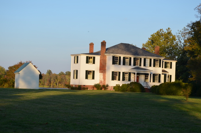
This is Riverview (c. 1846) on the south bank of the Rappahannock River in the historic town of Port Royal, Virginia. On December 4, 1862, Riverview was damaged by Union gunboats supporting the Fredericksburg Campaign of General Ambrose Burnside. The gunboats entered the Rappahannock River and fired on Port Royal. During the attack the Riverview House was struck several times. John Bernard Lightfoot moved his family to the Townfield House and kept the Lightfoot children in the cellar until the attack was finished. The next morning they evacuated Port Royal until the completion of the Battle of Fredericksburg. The Army of the Potomac returned to Port Royal from May through June 1864 as the wharves became a supply depot for the Army of the Potomac during Union General-in-Chief Ulysses S. Grant’s Overland Campaign.
On April 24, 1865 Harriet Lightfoot was with her daughter Maria Evelyn Lightfoot Kennon when they noticed a landing party arrive during darkness at the Riverview wharf. After observing John Wilkes Booth and David Edgar Herold exit the Rappahannock River ferry, Harriet Lightfoot asked John Wilkes Booth if they wanted shelter at Riverview. John Wilkes Booth declined and continued toward the streets of Port Royal where he attempted to obtain lodging at the Peyton House and Catlett House. He was directed to the tobacco farm of William H. Garrett where the manhunt for the assassin of President Abraham Lincoln would terminate when elements of the 16th Union Cavalry Regiment commanded by Lieutenant Edward Paul Doherty captured the conspirators.
John Bernard Lightfoot (December 24, 1814 – July 10, 1888) bequeathed Riverview to John Bernard Lightfoot Jr. and it was purchased at auction by Lewis Lightfoot, brother of the deceased. Riverview was then purchased in 1896 by Captain Sallie Tompkins, otherwise known as the “Nurse of the Confederacy”. She has the distinction of being the only commissioned female officer during the Civil War. She founded a hospital in Richmond, Virginia, funding the treatment of Confederate soldiers from her personal wealth. She is credited with understanding the importance of maintaining a clean hospital which saved the lives of hundreds of wounded soldiers. Captain Sallie Tompkins lived at Riverview until 1905. She was the cousin of Harriet Ann Field Lightfoot.
The Clark family included William Clark (1770-1838) of the Lewis & Clark Expedition to the Pacific, and Revolutionary War General George Rogers Clark (1752-1818). George Rogers Clark fought the British in present day Indiana and Illinois capturing three military outposts. This is historically significant as his actions secured the Old Northwest for the new United States. This eventually allowed President Thomas Jefferson to negotiate the Louisiana Purchase, and commission the Corps of Discovery which was led by his younger brother Lewis Clark. William Clark had a distinguished political career including the Governor of the Missouri Territory, and Superintendent of Indian Affairs.
Caroline County (Ladysmith) was once the home of George Rogers Clark, Revolutionary War hero, and William Clark of the famed Lewis and Clark Exploratory Expedition of the Northwest Territory from St. Louis to the Pacific Ocean. In 1803, President Jefferson secured the Louisiana Purchase from France, and appointed Meriwether Lewis to follow the Missouri River westward and find waterways which would connect to the Pacific Northwest. President Jefferson thought if the U.S. commanded trade routes which connected the Pacific Ocean to established trade points on the Mississippi River, the U.S. would eliminate the existence of Spain, France, and England from North America. Other goals of the expedition were to claim the Northwest and Oregon Territories for the United States before European nations. President Jefferson also wanted to declare U.S. sovereignty over Indian tribes living along the Missouri River. While also evaluating the economic potential of the land, the expedition took 28 months to complete, and covered 8,000 miles.
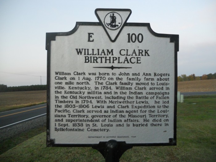
This is a 1995 Virginia Department of Historic Resources Marker. It is E-100 titled ‘William Clark Birthplace’. This marker is located next to County Line Baptist Church at 3461 Ladysmith Road in Ruther Glen. The inscription reads:
“William Clark was born to John and Ann Rogers Clark on 1 Aug. 1770 on the family farm about one mile north. The Clark family moved to Louisville, Kentucky, in 1784. William Clark served in the Kentucky militia and in the Indian campaigns in the Old Northwest, including the Battle of Fallen Timbers in 1794. With Meriwether Lewis, he led the 1803-1806 Lewis and Clark Expedition to the Pacific. Clark served as Indian agent for the Louisiana Territory, governor of the Missouri Territory, and superintendent of Indian affairs. He died on 1 Sept. 1838 in St. Louis and is buried there in Bellefontaine Cemetery.”
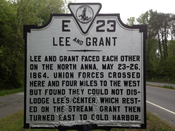
This is the 1929 Virginia Conservation & Development Commission historical marker #E-23 titled ‘LEE and GRANT’ is just north of the North Anna River on Jefferson Davis Highway (U. S. Route 1) in Caroline County. It outlines the Battle of North Anna during the Overland Campaign of Union General Grant’s march to Richmond with the Army of the Potomac. The marker reads:
“Lee and Grant faced each other on the North Anna, May 23-26, 1864. Union forces crossed here and four miles to the west but found they could not dislodge Lee’s center, which rested on the stream. Grant then turned east to Cold Harbor.”
Driving across the North Anna River into Caroline County on Jefferson Davis Highway (U. S. Route 1) you begin to pass several historical highway markers starting with ‘Lee and Grant’ (shown above). As Union General Grant pushed Confederate forces southward to Richmond along Telegraph Road (U. S. Route 1) these markers indicate the places of cavalry clashes, artillery strikes, delaying actions, and changes in direction of both armies.
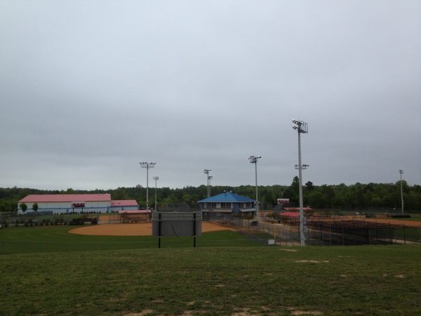
The Virginia Sports Complex is 3 miles off of Rogers Clark Boulevard (Route 207) and I-95 exit 104 (Carmel Church). It is 30 miles north of Richmond and 25 miles south of Fredericksburg.
The most unique attraction in Caroline County is the Virginia Sports Complex in Ruther Glen. It is a privately owned baseball and softball tournament destination for travel and showcase baseball. Virginia Sports Complex has 4 baseball and 4 softball fields (professional grade), a 40,000 square feet indoor facility with artificial turf, a recruiting and evaluation observation deck, 6 outdoor and 7 indoor batting cages, weight training center, several concessions and snack bar, and meeting room.
A great farm market is Mount Olympus Berry Farm which is a family owned farm located just south of the Virginia Sports Complex. Mount Olympus Berry Farm has pick-your-own strawberries, blueberries and blackberries, along with fresh vegetables. The garden center offers several varieties of flowers, shrubs, and unique plants. Mount Olympus also provides produce to farmer’s markets in Fairfax County (Annandale, Burke, Herndon, Lorton, McLean and Reston), Prince William County (Dale City), and the Bowling Green community market. Check the website for seasonal vegetables and fruits, farm market calendar of events, and fruit (dessert) and vegetable recipes.
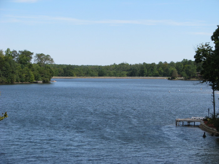
The Lake Land’Or community has 2 lakes which have beaches and support boating and fishing. Lake Land’Or (87 acres) is shown here.
Lake Land’Or is a gated community in Caroline County is located 3 miles west of Interstate 95 exit 110 (Ladysmith) on Route 639 (Ladysmith Road). Lake Land’Or is almost 2000 acres containing 2 miles of paved roads, and 3 lakes supporting boating, fishing, and recreational activities. There are 13 fishing ponds for resident use. Lake Land’Or is 20 miles south of Fredericksburg, and 25 miles north of Richmond. Community amenities include boat launches, beaches, and pavilions at Lake Land’Or and Heritage Lake. A skeet shooting range, tennis courts, archery range, campground, swimming pools, and several athletic facilities are among many benefits offered to residents at Lake Land’Or.
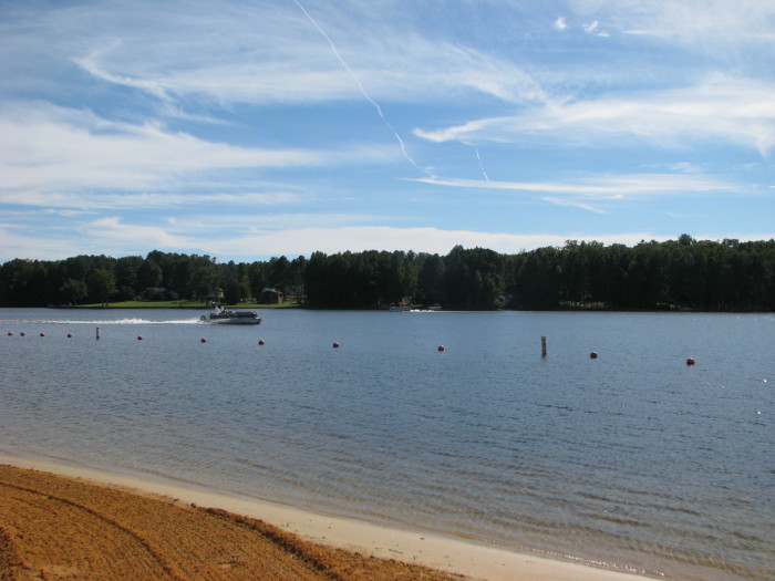
Lake Caroline covers 277 acres and is over 2 miles long with a depth averaging 15 feet, and 32 feet at its deepest point. It has 10 miles of shoreline and is fed by several natural sources.
Lake Caroline is 1 mile south of Ladysmith Road (Route 639) on Jefferson Davis Highway (U. S. Route 1). Lake Caroline is also a gated community with more than 1,000 single family homes on 1,500 wooded acres. Amenities at Lake Caroline include basketball courts, boating (36 m.p.h. speed limit), bocce ball court, campground (featuring 9 large camper spaces with electricity, restrooms and showers), fishing, lakes (Caroline, Ladysmith, Madison), 2 beaches (both have covered pavilions, swim platforms, playgrounds, athletic courts, restrooms, and boat launches), the Lodge (community center for meetings, parties, and special events), pool (25 meters with zero-entry ramp and kids pool), 10 recreation areas (playgrounds, picnic tables, pavilions, boat docks), and 2 tennis courts.
Contact us if buying or selling homes in Caroline County are in your future plans.

